
The wadis and hills around Petra contained neolithic villages as early as 7000 B.C.E. During the Iron Age, Edomites lived in the area. They were pushed west into Judea by the Nabateans, who came from western Arabia about 600 B.C.E. to build Petra. The city had a population of around 30,000 at its height. The Romans conquered Petra in 106 C.E. and added typically Roman architecture. During the Byzantine time, some Nabatean buildings were turned into churches. Earthquakes in 363 and 551 C.E. toppled many of the buildings, and the city was mostly abandoned (and forgotten in the West) after the 14th century C.E. until Swiss traveler Johann Ludwig Burckhardt rediscvered it in 1812.
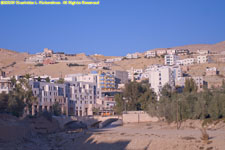
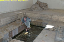
Modern Wadi Musa (Valley of Moses) and 'Ain Musa (Moses's Spring):
Djinn Blocks:
Entrance to Petra: the Obelisk Tomb and Bab As-Siq Triclinium:
As-Siq, the narrow gorge, is the main entrance to Petra:
Al-Khazneh (the Treasury, tomb of King Aretas III), the first sight you see when you exit from the slot canyon:
The Outer Siq:
Street of Facades and the Theatre (Nabataean tombs):
Royal Tombs:
The Urn Tomb:
Colonnaded Street, the center of Petra:
Qasr al-Bint, probably the main temple of the Nabataean capital, is the only free-standing bulding in Petra that has survived earthquakes and floods:
Up into the mountains to Al-Deir (the Monastery), built in the 3rd century B.C.E. as a Nabataean tomb, with view of Aaron's Tomb on Mount Hor (Jebel Haroun) and Wadi Araba:
©2010 Mermaid Underwater Photographic. All Rights Reserved.
Contact us at mermaid@underwater.org.
Last modified 18 January 2014